
Miles and Miles of Trails within minutes...
Forestry Service Maps
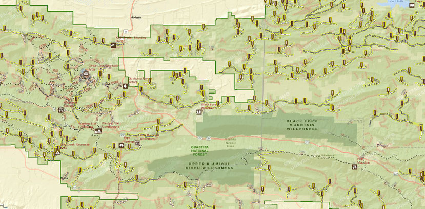
Using the link below will take you to the online interactive visitors map provided by the National Forestry Service. This will show not only the trails for OHV use both over and under 50 inches, but will show walking trails, horseback riding trails and points of interest.
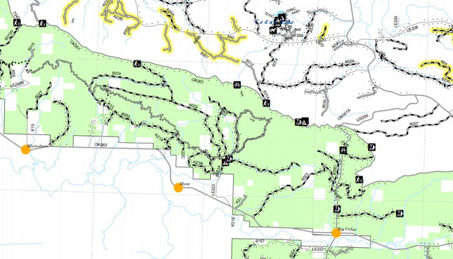
Billy Creek
Located just a few miles from our office on Hwy 63 in the community of Big Cedar.
Wolf Pen Gap
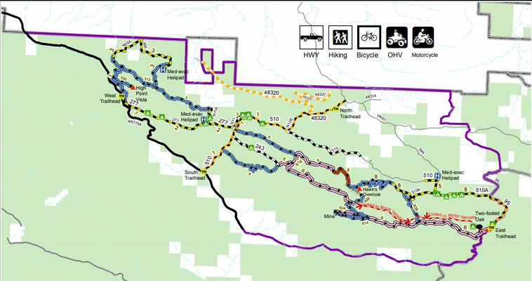
Located approximately 45 miles east of us is the very popular Wolf Pen Gap trails network. This trail network gets heavy use in the spring time. There are a lot of trail riding options from easy to challenging.
West Trailhead: From Mena, take State Highway 8 east for 1 mile to Arkansas 375, then south 8 miles to the trailhead near County Road 277.
South Trailhead: Farther south on Arkansas 375 on the left.
East Trailhead: From Mena take Hwy. 8 east about 20 miles (about 1 mile east of Big Fork), turn right on Polk County Rd. 83 (Forest Road 38), travel 5 miles to the East Trailhead.
North Trailhead: From Mena, take Hwy. 8 east of 10 miles to Polk County Rd. 61, travel 3.5 miles, turn right at the sign, go 1/2 mile to the North Trailhead.
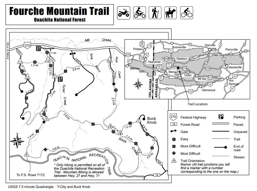
The Fourche Mountain Trail (formerly Mill Creek Equestrian Trail) offers breathtaking views of Fourche Mountain and Buck Knob. Beautiful streams, and several spectacular views of the Ouachita Mountains are among the trail sites. While this trail network provides horseback riding opportunities, it also offers day hiking, mountain biking, ORV and motorcycle riding.
Please keep UTV's on designated trails. These units are too wide for a lot of ATV only trails. If you get stuck on a trail that is designated ATV use and we have to rescue the unit, we charge $100 per hour from the time you call until the time we return to the office. Not to mention, there is a high likelihood of damage to the unit and you will be charged for those damages. See damage waiver for more details.